

Sponsored by HS Foot Care Services
4.9 miles. Time 1.5 hours
Postcode LE12 7LZ
Park at Sileby village car park
(SK 6019 1517) Point 1 on the map.
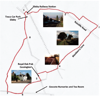
- Walk through the alleyway adjacent to the railway line and out onto Brook Street. Turn left heading North-East under the railway bridge. Continue on the main road as it becomes The Banks and Ratcliffe Rd. It is worth pausing part way up the hill and turning to look back at Sileby and surrounds, although mostly built up, the expanse and undulations of the scene are quite impressive.
- At the top of the hill, a footpath into fields is signed on the left; immediately bear right to follow the path around the edge of the field and buildings, heading down hill and following the path to the left. Cross the footbridge on the right, continuing uphill to a tarmac drive.
- Turn right onto the drive, shortly crossing the busy Ratcliffe Road and head down the full length of Blackberry Lane straight opposite.
- Blackberry Lane emerges onto Back Lane at a sharp bend, turn right to cross over the railway bridge, heading towards Cossington. Take the first right (Bennetts Lane) and continue, emerging onto Main Street. Turn left, enjoying the ambience of this attractive village.
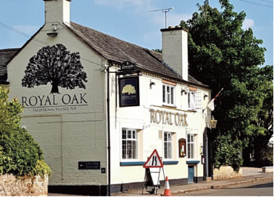
- If you fancy refreshment at this point, you will shortly reach the Royal Oak public house on the left (https://www.facebook.com/CossingtonRoyalOak/).
- If you prefer a cup of tea and a cake, turn right down Platts Lane there is a tea room at Goscote Nurseries, located on the left as you emerge onto Syston Road. To continue, head West onto Syston Road along a footpath and layby.
- At a large metal gate, turn right to head North into Cossington Meadows keeping on the wide, gravelled track. Shortly after a crossroads in the track, continue through a wooden gate. A further gate takes the path diagonally over a meadow, crossing a stream in the middle and leading to a stile onto a narrow footpath, which after a sharp right turn emerges onto Cossington Road in Sileby.
- Turn left onto Cossington Road which will bring you to the centre of Sileby. At the Barnardo’s charity shop and a small supermarket head right down the alleyway to the car park where the walk began.
While the instructions and overview map given should give you a good idea of the walk, the easiest way to see the full route detail is to look at it on the OS Maps website
https://osmaps.ordnancesurvey.co.uk/route/5772244/SVLSilebytoCossingtonRound OS Maps provide a free App which can be downloaded to any smartphone or tablet from your app store. Once you have registered the app, you can sign in at the link above and add the walk to your favourites to allow easy viewing within the App. The basic mapping will be sufficient for most popular footpaths, although subscriptions are available for more detailed maps.
© Soar Valley Life Peter & Beverley Collet and Steve Johns
Please observe the Countryside Code:
https://www.gov.uk/government/publications/thecountrysidecode/countrysidecodefullonlineversion

